LiDAR UAV: Is It Worth an Investment?
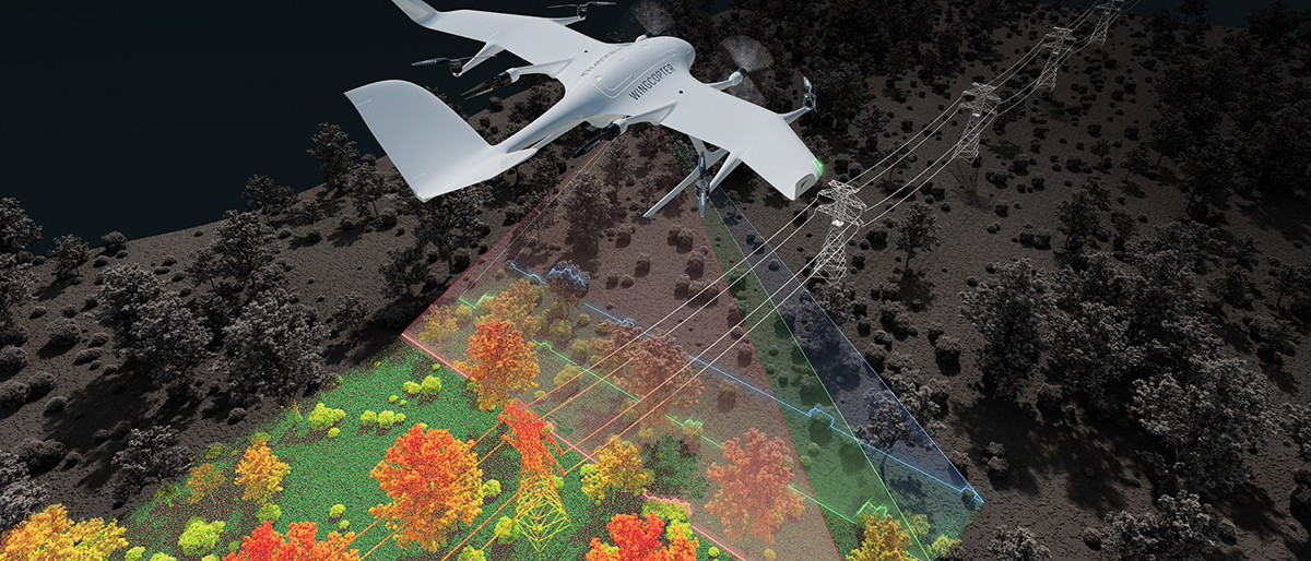
In 2016, the U.S. Federal Aviation Administration (FAA) authorized using drones weighing 55 pounds or less. LiDAR UAV mapping was one of the first new use cases, used to survey vegetation enrichment across power lines.
Almost a decade later, LiDAR UAV sensors and payloads are plenty to go around. But are they a good investment? Here’s our take.
Advantages of a UAV LiDAR Sensor
LiDAR is kind of like echolocation but with light — it measures distance by bouncing laser beams off objects. This capability adds some major improvements to autonomous navigation, obstacle detection, and land surveying.
Autonomous Navigation in GPS-Denied Environments
UAV LiDAR sensors allow drones to stay on the flight path even when the GPS signal is weak or absent. Thanks to Simultaneous Localization and Mapping (SLAM), drones can be programmed to create a live 3D map of the surroundings to localize itself. For instance, Flyability Elios 3 uses a combination of computer vision, LiDAR payload, and an NVIDIA GPU to instantaneously create a live point cloud for indoor navigation.
SLAM enables a host of drone use cases in mining — shaft and tunnel exploration, geotechnical stability analysis, and terrain mapping among others. Likewise, it improves indoor drone deployments in large warehouses or storage tanks, where GNSS signal interference is high.
Real-Time Obstacle Detection and Avoidance
LiDAR lends UAVs extra ‘sensing powers’ for early obstacle detection and avoidance. Modern sensors emit laser pulses in all directions (often with a spinning scanner or multi-beam setup), giving the drone a 360° situational awareness without relying on a pilot camera.
State-of-the-art LiDAR-based collision avoidance systems can compute avoidance trajectories for drones in just 50 milliseconds. In practice, this means a UAV can traverse complex terrains — busy urban areas, industrial sites, or forests with dense vegetation — even in full auto-pilot mode.
Cost-Effective Surveying and Mapping
Mapping is arguably where LiDAR makes the most difference. Specialized LiDAR payloads measure the ground distance with centimeter-level precision, supplying surveyors with detailed digital terrain models (DTMs) and digital surface models (DSMs).
Because the best long-range drones can fly relatively low and slow (thanks to a bigger battery), you can collect a high density of points, capturing fine terrain features like narrow power lines or moving animals in less time. Topographic surveys, which used to take weeks with conventional methods, can now be done in a day.
Disadvantages of a UAV LiDAR
Adding LiDAR sensors to drones unlocks new enviable capabilities. But just like with any other technology, there are several tradeoffs.
Higher Power Consumption
UAV LiDAR sensors are on the bulky side, meaning less stability and reduced flight time. Flyability Elios 3 drone has a regular flight time of 12 minutes, which drops to just 9 when
A LiDAR payload is mounted. For VTOLs with bigger batteries, high power consumption is less of a pickle. However, ensuring proper power management for a custom LiDAR payload can require some structural modifications.
High Price Tag
Compared to a decade ago, LiDAR UAV technology has become more affordable. Still, the cost of an entry-level drone LiDAR systems start at around $2,000 to $5,000. If you want higher precision systems with embedded quality assurance for commercial or tactical applications, be prepared to spend north of $20K.
Positioning Accuracy
The accuracy of LiDAR data depends on the drone’s positioning system. Standard GNSS receivers in starter drones offer positional accuracy of about 5-10 meters, which isn’t enough for mapping use cases. For better results, you’ll need Differential GNSS systems like RTK or PPK improve positional accuracy to 1-2 centimeters. But this means extra investment and dependency on GPS signal quality.
Alternatives to LiDAR for Smooth Navigation
If you’re main use case for LiDAR UAV is (semi)autonomous navigation in GPS-denined environments, there’s a great alternative to LiDAR — Bavovna’s AI Navigation Kit.
Unlike expensive and bulky LiDAR systems, Bavovna’s device is low SWAP. The max current consumption is just 10A, and it’s compatible with a standard +5V power supply. Instead of using LiDAR, Bavovna applies AI fusion to process UAV INS data and supply the drone with situational awareness. Custom-trained on live flight data, our system has an
end point positioning error of under 0.5% in GPS-denined environments.
Learn more about Bavovna’s AI Navigation Kit


